|
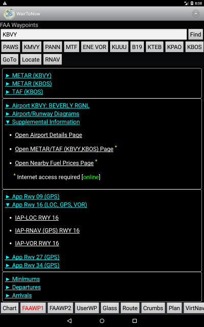
- Enter the identifier of the desired waypoint in the text box at the top and
click the Find button.
- You may also enter search words such as a city name.
- Entering multiple words requires that the waypoint
description contains all the words given in the search box.
- The search is case-insensitive.
- Only letters and numbers are searched, all other characters are
treated as spaces separating words.
- The first word given must be found whole, the other words may be
partials.
- It searches the FAA, OA, OFM databases depending on which
databases are enabled on the
Options page. Consequently,
when searching for a particular waypoint, you may get duplicates
if there is more than one database currently enabled. You must
then choose which one you want from the presented menu.
- You may also click one of the history buttons listed below the text box
to get a recent waypoint. Long-click the button to delete it from the list.
- The GoTo button will set the waypoint as the current destination
and a line will be drawn from the airplane to the destination location
on the Chart page.
- The Locate button will center the moving map of the
Chart page on the waypoint. If the
screen goes black, it just means the waypoint is not on the current
chart, so you must click the Chart button to select a different
chart.
- The RNAV button will allow entry of an RNAV-like offset from the
current waypoint to create a new waypoint.
- Description information for the waypoint will be displayed next.
- Secondary pages are available for airports, provided the
plates for the airport's
state have been downloaded. Links will be shown to display plates
for this airport, including:
Clicking on the link will display the item as a secondary page.
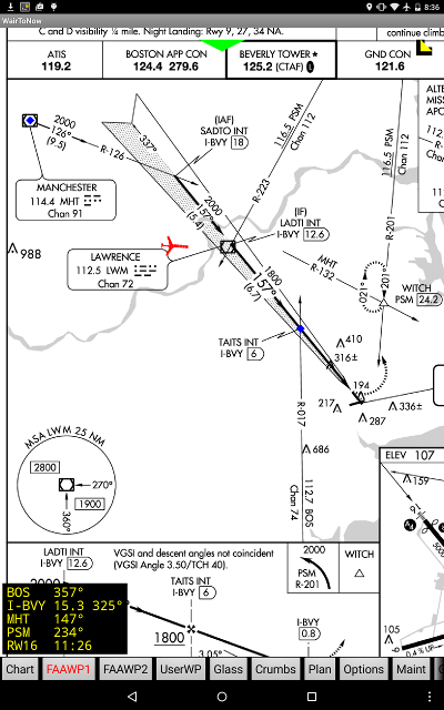
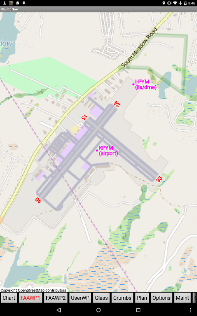
- Georeferencing will be provided for the APD, IAP
and RWY diagrams, depicting the current airplane
position provided it is within the area of the diagram.
|
- Get to primary page by either clicking Android's Back
button or the corresponding Waypt1/2 button.
|